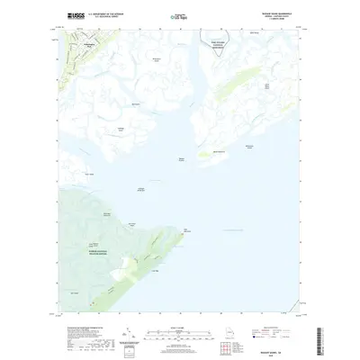
2020 Map of Wassaw Sound
USGS Topo · Published 2020About this map
Wilmington Island and the intricate coastal estuaries of the Sea Islands dominate this 2020 landscape, where the tides of the Atlantic meet a complex network of sounds and marshes. The residential streets of Wilmington Park, including Devonshire Rd and Walthour Rd, stand in contrast to the protected wilderness of the Wassaw National Wildlife Refuge on Wassaw Island. This area preserves the barrier island ecosystem, featuring landmarks like Dead Man Hammock and the secluded Otter Pond.
Find a feature on this map
71 named features on this map. Tap any name to fly to it.
Don’t see what you’re looking for? This feature index may not catch every label — zoom into the map to look around manually.
Map Details
Editions of this 2020 Wassaw Sound Map
This is the sole edition of this map. No revisions or reprints were ever made.
Other maps of this area

1920 · Wassaw Sound
USGS Topo · 1:62,500

1920 · Bluffton
USGS Topo · 1:62,500

1942 · Savannah
USGS Topo · 1:62,500

1944 · Ossabaw Island
USGS Topo · 1:62,500

1945 · Bluffton
USGS Topo · 1:62,500

1945 · Ossabaw Island
USGS Topo · 1:62,500

1945 · Wassaw Sound
USGS Topo · 1:62,500

1946 · Brunswick
USGS Topo · 1:250,000

1947 · Savannah
USGS Topo · 1:250,000

1948 · Brunswick
USGS Topo · 1:250,000