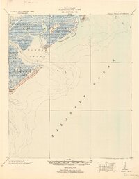
1920 Map of Wassaw Sound
USGS Topo · Published 1920About this map
Wassaw Island and the intricate coastal waterways of the Georgia shoreline are documented here in a survey compiled by the Corps of Engineers. This tactical map emphasizes the complex maritime geography of the region, featuring defensive infrastructure such as the Great Wassaw Old Battery and a landmark Cup of Hotel on the northern reaches. The landscape is defined by its transition from tidal marshes and creeks, like Romerly Marsh Creek, to the open expanse of the Atlantic Ocean.
Find a feature on this map
25 named features on this map. Tap any name to fly to it.
Don’t see what you’re looking for? This feature index may not catch every label — zoom into the map to look around manually.
Map Details
Editions of this 1920 Wassaw Sound Map
This is the sole edition of this map. No revisions or reprints were ever made.
Other maps of this area
1920 · Hilton Head
USGS Topo · 1:62,500
1920 · Bluffton
USGS Topo · 1:62,500
1928 · St Catherines Island
USGS Topo · 1:62,500
1942 · Savannah
USGS Topo · 1:62,500
1943 · St Catherines Island
USGS Topo · 1:62,500
1944 · Ossabaw Island
USGS Topo · 1:62,500
1945 · St. Catherine's Island
USGS Topo · 1:62,500
1945 · Bluffton
USGS Topo · 1:62,500
1945 · Ossabaw Island
USGS Topo · 1:62,500
1945 · Hilton Head
USGS Topo · 1:62,500