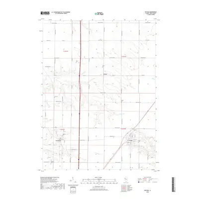
2018 Map of Wataga
USGS Topo · Published 2018About this map
The settlement of Wataga anchors the southeastern corner of this Knox County landscape, where the local street grid includes names like W Miners St and E Coal St that hint at the area's industrial past. To the west, Henderson sits near the winding course of Henderson Creek, which provides drainage alongside Pennington Creek and S Henderson Creek. This region is particularly rich for genealogical research, featuring an unusually high concentration of pioneer and family-named burial sites. These include the Ontario Cem near the small community of Ontario, as well as the Bruner Cem, Robbins Cem, and the uniquely named Junk Cem. The map further documents the specialized Galesburg Research Cem and Gum Cem, offering a detailed view of the rural cemetery distribution across T13N R1E and T12N R2E.
Find a feature on this map
38 named features on this map. Tap any name to fly to it.
Don’t see what you’re looking for? This feature index may not catch every label — zoom into the map to look around manually.
Map Details
Editions of this 2018 Wataga Map
This is the sole edition of this map. No revisions or reprints were ever made.
Other maps of this area

1925 · Galesburg
USGS Topo · 1:62,500

1927 · Galesburg
USGS Topo · 1:62,500

1931 · Galva
USGS Topo · 1:48,000

1940 · Galva
USGS Topo · 1:62,500

1941 · Maquon
USGS Topo · 1:62,500

1943 · Maquon
USGS Topo · 1:62,500

1944 · Galva
USGS Topo · 1:62,500

1947 · Woodhull
USGS Topo · 1:62,500

1953 · Nekoma
USGS Topo · 1:24,000

1953 · Woodhull
USGS Topo · 1:24,000