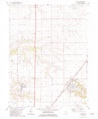
1982 Map of Wataga
USGS Topo · Published 1983About this map
Wataga and Henderson anchor this Knox County landscape, serving as the primary centers of settlement during the early 1980s. The region is defined by a dense network of local burial grounds, including the Bruner Cem, Ontario Cem, and Gum Cem, which provide significant touchstones for genealogists tracing family roots through Ontario and Sparta townships. The Burlington Northern railroad cuts a diagonal path through the southeastern corner, while an Old RR Grade north of Wataga hints at former transportation corridors that once shaped the local economy. Agriculture and light infrastructure predominate, evidenced by features like the Johnson Landing Strip and a series of pipelines crossing the creek-fed terrain. The distinct branches of Henderson Creek and South Henderson Creek drain the western portion of the quadrangle, illustrating the natural drainage patterns that influenced the placement of original homesteads and small communities like Gehring.
Find a feature on this map
24 named features on this map. Tap any name to fly to it.
Don’t see what you’re looking for? This feature index may not catch every label — zoom into the map to look around manually.
Map Details
Editions of this 1982 Wataga Map
This is the sole edition of this map. No revisions or reprints were ever made.
Other maps of this area

1925 · Galesburg
USGS Topo · 1:62,500

1927 · Galesburg
USGS Topo · 1:62,500

1931 · Galva
USGS Topo · 1:48,000

1940 · Galva
USGS Topo · 1:62,500

1941 · Maquon
USGS Topo · 1:62,500

1943 · Maquon
USGS Topo · 1:62,500

1944 · Galva
USGS Topo · 1:62,500

1947 · Woodhull
USGS Topo · 1:62,500

1953 · Nekoma
USGS Topo · 1:24,000

1953 · Woodhull
USGS Topo · 1:24,000