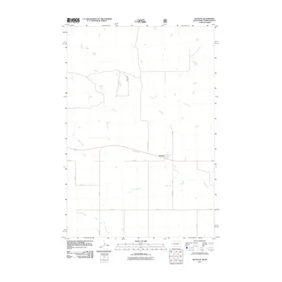
2011 Map of Watauga
USGS Topo · Published 2011About this map
The small settlement of Watauga sits at the intersection of local history and the expansive landscape of the Rock Creek District. This 2011 survey captures the area at a time when the rural road network, defined by routes like County Rd 6597 and 102nd St, remained essential for connecting isolated farmsteads and ranching lands. The hydrology of the region is a defining characteristic, with the winding paths of Timber Creek, Hump Creek, and Red Willow Creek carving through the terrain. These waterways provide a clear indication of the natural drainage patterns in this portion of South Dakota, where the placement of roads often follows the contours shaped by these intermittent streams. The map serves as a detailed record of the township and range system, showing the precise grid of secondary roads such as 226th Ave and 230th Ave that partition the Great Plains.
Find a feature on this map
14 named features on this map. Tap any name to fly to it.
Don’t see what you’re looking for? This feature index may not catch every label — zoom into the map to look around manually.
Map Details
Editions of this 2011 Watauga Map
This is the sole edition of this map. No revisions or reprints were ever made.
Other maps of this area

1953 · McIntosh
USGS Topo · 1:250,000

1954 · Bismarck
USGS Topo · 1:250,000

1958 · Bismarck
USGS Topo · 1:250,000

1958 · McIntosh
USGS Topo · 1:250,000

1971 · Lookout Butte
USGS Topo · 1:24,000

1972 · McIntosh SW
USGS Topo · 1:24,000

1972 · Morristown
USGS Topo · 1:24,000

1972 · Morristown SE
USGS Topo · 1:24,000

1972 · Skull Butte
USGS Topo · 1:24,000

1972 · Watauga
USGS Topo · 1:24,000
Featured Places
- Watauga, Rock Creek District
- Porcupine District, ND
- Rock Creek District, SD
- Sioux County, ND
- Corson County, SD