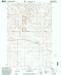
1998 Map of Watauga
USGS Topo · Published 2001About this map
Watauga sits at the heart of this late-twentieth-century landscape along the border of Sioux and Corson counties. The map captures a high plains environment defined by its vast grazing lands and the vital water sources that sustain them, including Timber Creek, Hump Creek, and Red Willow Creek. To the north, the Cedar River National Grassland provides a protected buffer across the state line into North Dakota.
Find a feature on this map
19 named features on this map. Tap any name to fly to it.
Don’t see what you’re looking for? This feature index may not catch every label — zoom into the map to look around manually.
Map Details
Editions of this 1998 Watauga Map
This is the sole edition of this map. No revisions or reprints were ever made.
Other maps of this area

1953 · McIntosh
USGS Topo · 1:250,000

1954 · Bismarck
USGS Topo · 1:250,000

1958 · Bismarck
USGS Topo · 1:250,000

1958 · McIntosh
USGS Topo · 1:250,000

1971 · Lookout Butte
USGS Topo · 1:24,000

1972 · McIntosh SW
USGS Topo · 1:24,000

1972 · Morristown
USGS Topo · 1:24,000

1972 · Morristown SE
USGS Topo · 1:24,000

1972 · Skull Butte
USGS Topo · 1:24,000

1972 · Watauga
USGS Topo · 1:24,000
Featured Places
- Watauga, Rock Creek District
- Porcupine District, ND
- Rock Creek District, SD
- Sioux County, ND
- Corson County, SD