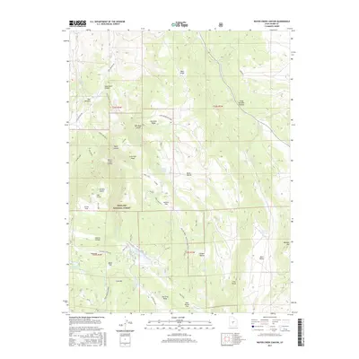
2017 Map of Water Creek Canyon
USGS Topo · Published 2017About this map
Fishlake National Forest dominates this high-elevation landscape in Sevier County, characterized by a complex network of forest roads and trails that connect isolated mountain reservoirs and springs. The terrain is defined by prominent elevations such as Cove Mtn and Mormon Mtn, which frame deep depressions like Henries Hollow and Killian Hollow. Water management is central to the area's geography, with the presence of Davis Hollow Reservoir, Annabella Reservoir, and Bear Valley Reservoir suggesting a landscape modified for irrigation or livestock support in an otherwise arid region. Extensive trail systems, including Trail 4765 and the Annabella-Deep Lake route, traverse the ridges and flats. These paths link landmarks like Lone Pine Ridge and Red Pine Ridge, providing a detailed look at the 21st-century configuration of these public lands.
Find a feature on this map
61 named features on this map. Tap any name to fly to it.
Don’t see what you’re looking for? This feature index may not catch every label — zoom into the map to look around manually.
Map Details
Editions of this 2017 Water Creek Canyon Map
This is the sole edition of this map. No revisions or reprints were ever made.
Other maps of this area

1885 · Beaver
USGS Topo · 1:250,000

1885 · Fish Lake
USGS Topo · 1:250,000

1896 · Fish Lake
USGS Topo · 1:250,000

1940 · Monroe
USGS Topo · 1:62,500

1944 · Monroe
USGS Topo · 1:62,500

1953 · Richfield
USGS Topo · 1:250,000

1956 · Salina
USGS Topo · 1:250,000

1958 · Richfield
USGS Topo · 1:250,000

1960 · Salina
USGS Topo · 1:250,000

1961 · Richfield
USGS Topo · 1:62,500