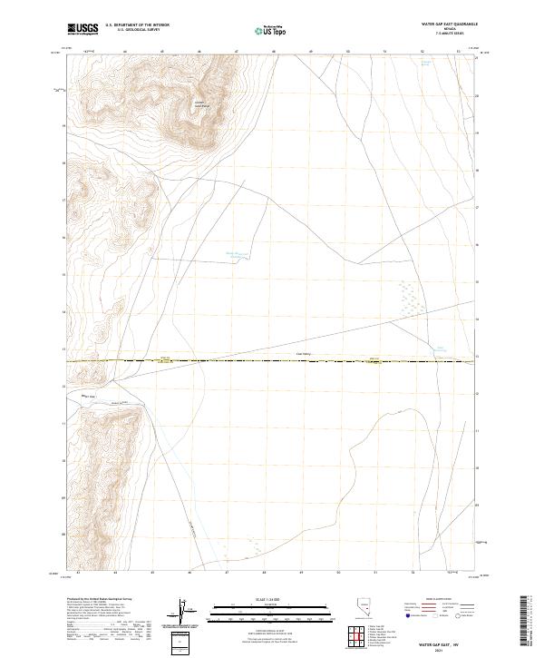
2021 Map of Water Gap East
USGS Topo · Published 2021About this map
The Golden Gate Range dominates the northern landscape of this Nevada interior, giving way to the expansive floor of Coal Valley. This map documents a high-desert environment where water management is the primary marker of human activity, defined by small catchments such as Sheep Reservoir Number 1 and Line Reservoir that support the local rangeland. The boundary between Nye and Lincoln counties bisects the valley, running through an area largely devoid of permanent settlements but marked by essential infrastructure like Seaman Wash Rd. In the southwest, the distinctive Water Gap provides a natural corridor through the terrain, while Triangle Spring in the northeast remains a critical natural water source. The grid-based public land survey system organizes this open country into townships like t3n r59e, illustrating how the desert is partitioned for management and grazing.
Find a feature on this map
12 named features on this map. Tap any name to fly to it.
Don’t see what you’re looking for? This feature index may not catch every label — zoom into the map to look around manually.
Map Details
Editions of this 2021 Water Gap East Map
This is the sole edition of this map. No revisions or reprints were ever made.
Other maps of this area

1954 · Caliente
USGS Topo · 1:250,000

1956 · Lund
USGS Topo · 1:250,000

1959 · Caliente
USGS Topo · 1:250,000

1960 · Lund
USGS Topo · 1:250,000

1970 · Oreana Spring
USGS Topo · 1:24,000
1971 · Timber Mtn Pass NW
USGS Topo · 1:24,000
1971 · Timber Mtn Pass West
USGS Topo · 1:24,000

1985 · Water Gap East
USGS Topo · 1:24,000

1985 · Coal Valley Reservoir
USGS Topo · 1:24,000

1985 · Murphy Gap NW
USGS Topo · 1:24,000