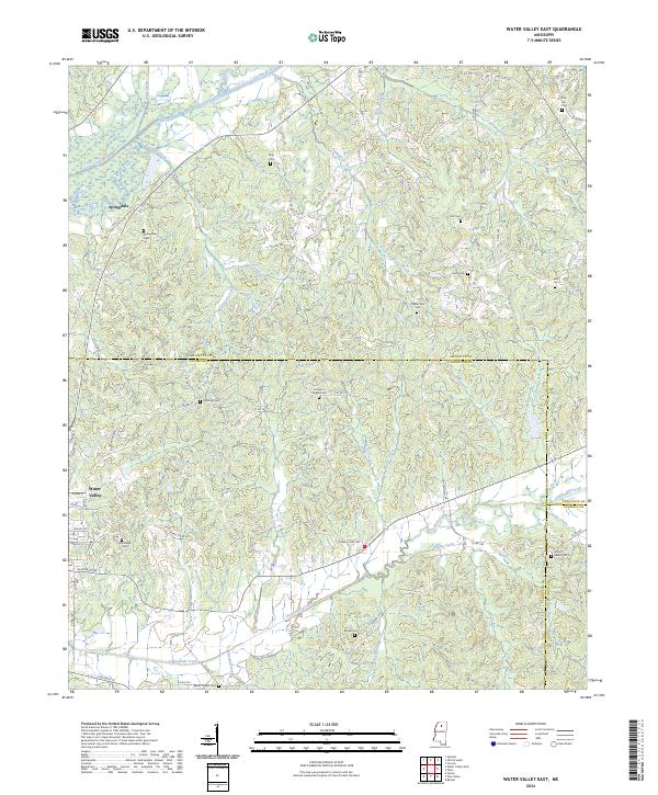
2024 Map of Water Valley East
USGS Topo · Published 2024About this map
Otoucalofa Creek and Spring Creek wind through the hills of this region southeast of the Water Valley town center. The landscape is defined by its numerous small-scale family and community burial grounds, illustrating a long-established rural settlement pattern where residents were often interred near their homes or congregational meeting places. Prominent local landmarks include Jumper's Chapel Cem and Pilgrim Rest Cem, while the community of Springdale sits in the northwest, tucked between the Yocona River and Goodwin Creek. The map documents a dense network of county roads like Co RD 378 and Co RD 374 that cross the ridges and valleys between Lafayette, Yalobusha, and Calhoun counties. These drainage patterns, such as Greasy Creek and Moore Creek, dictate the winding paths of the local transport network as it serves the scattered homesteads of north-central Mississippi.
Find a feature on this map
91 named features on this map. Tap any name to fly to it.
Don’t see what you’re looking for? This feature index may not catch every label — zoom into the map to look around manually.
Map Details
Editions of this 2024 Water Valley East Map
This is the sole edition of this map. No revisions or reprints were ever made.
Other maps of this area

1940 · Oxford
USGS Topo · 1:62,500

1942 · Denmark
USGS Topo · 1:62,500

1943 · Denmark
USGS Topo · 1:62,500

1943 · Oxford
USGS Topo · 1:62,500

1954 · Water Valley
USGS Topo · 1:62,500

1954 · Water Valley West
USGS Topo · 1:24,000

1955 · Water Valley
USGS Topo · 1:62,500

1956 · Tupelo
USGS Topo · 1:250,000

1958 · Tupelo
USGS Topo · 1:250,000

1972 · Paris
USGS Topo · 1:24,000