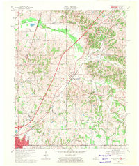
1969 Map of Water Valley
USGS Topo · Published 1971About this map
The Illinois Central Railroad and the newly appearing Purchase Parkway define the late-1960s transport corridor of this rural region, where the state lines of Kentucky and Tennessee meet at Fulton and South Fulton. This area is marked by a network of drainage systems like the Bayou de Chien and South Fork Bayou de Chien, which wind through a landscape of family farms and small rural settlements.
Find a feature on this map
47 named features on this map. Tap any name to fly to it.
Don’t see what you’re looking for? This feature index may not catch every label — zoom into the map to look around manually.
Map Details
Editions of this 1969 Water Valley Map
2 editions found
Other maps of this area

1952 · Clinton
USGS Topo · 1:24,000

1952 · Mayfield
USGS Topo · 1:24,000

1952 · Dublin
USGS Topo · 1:24,000

1952 · Crutchfield
USGS Topo · 1:24,000

1952 · Cuba
USGS Topo · 1:24,000

1952 · Water Valley
USGS Topo · 1:24,000

1952 · Mayfield
USGS Topo · 1:62,500

1952 · Water Valley
USGS Topo · 1:62,500

1956 · Harris
USGS Topo · 1:24,000

1956 · Mc Connell
USGS Topo · 1:24,000