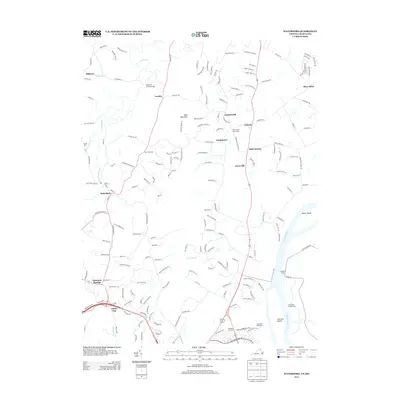
2013 Map of Waterford
USGS Topo · Published 2013About this map
Waterford serves as the focal point of this Northern Virginia landscape, surrounded by a network of crossroads and small settlements like Loyalty, Goresville, and Lucketts. The topography is defined by the winding course of Catoctin Creek and its branches, which drain toward the Potomac River. Significant historical and recreational markers are found throughout the area, notably the Balls Bluff Battlefield and the sprawling estate of Morven Park. The map documents the enduring presence of river crossings at Whites Ferry and Potomac Crossing, alongside prominent terrain features such as Bald Mountain and the low-lying Back Swamp. These details highlight a region where historical preservation and early transportation routes, including the Catoctin Creek Bridge, continue to shape the modern landscape near the Maryland border.
Find a feature on this map
179 named features on this map. Tap any name to fly to it.
Don’t see what you’re looking for? This feature index may not catch every label — zoom into the map to look around manually.
Map Details
Editions of this 2013 Waterford Map
This is the sole edition of this map. No revisions or reprints were ever made.
Other maps of this area

1884 · Harpers Ferry
USGS Topo · 1:125,000

1891 · Harpers Ferry
USGS Topo · 1:125,000

1893 · Frederick
USGS Topo · 1:125,000

1893 · Harpers Ferry
USGS Topo · 1:125,000

1894 · Frederick
USGS Topo · 1:125,000

1908 · Middletown
USGS Topo · 1:48,000

1908 · Seneca
USGS Topo · 1:62,500

1908 · Ijamsville
USGS Topo · 1:62,500

1909 · Ijamsville
USGS Topo · 1:62,500

1910 · Antietam
USGS Topo · 1:62,500