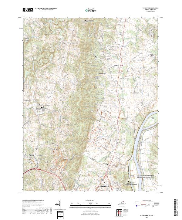
2022 Map of Waterford
USGS Topo · Published 2022About this map
Catoctin Mtn forms a prominent ridgeline through this northern Virginia landscape, separating the village of Waterford from the Potomac River valley. This 2022 survey documents a region of deep historical significance, notably at the Balls Bluff National Cemetery near Leesburg, commemorating a pivotal Civil War engagement. The map reveals the intricate social fabric of the area through its numerous burial grounds and places of worship, including the Waterford Union of Churches Cem and the Black Waterford Union of Churches Cem, illustrating the community's ancestral heritage. Along the river, the Chesapeake and Ohio Canal National Historical Park preserves the corridor of early American trade, while small settlements like Stumptown, Lucketts, and Paeonian Springs define the rural crossroads between Catoctin Creek and the Maryland border.
Find a feature on this map
195 named features on this map. Tap any name to fly to it.
Don’t see what you’re looking for? This feature index may not catch every label — zoom into the map to look around manually.
Map Details
Editions of this 2022 Waterford Map
This is the sole edition of this map. No revisions or reprints were ever made.
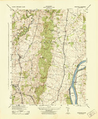
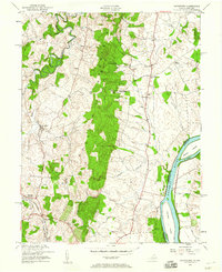
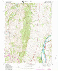
Historical Maps of Paeonian Springs Through Time
4 maps found