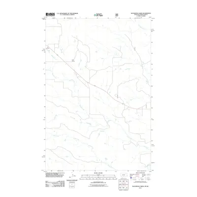
2011 Map of Waterhole Creek
USGS Topo · Published 2011About this map
Fertile Prairie Cemetery sits amidst a network of drainage basins in this section of Fallon County, marking a site of local genealogical significance within a sparsely settled landscape. The terrain is defined by the winding paths of several watercourses, including Waterhole Creek, Corral Creek, and Buffalo Creek, which reveal the natural hydrology of the eastern Montana plains. These creeks weave through the quadrangle, converging toward Little Beaver Creek in the southeast. Man-made interventions in the environment are sparse but notable, such as Lang Dam in the northwest corner and the diagonal path of Route 12. The presence of established section lines and rural routes like 7971 and 7972 illustrates the organized grid system that governs this ranching and agricultural region, where wide-open spaces are occasionally interrupted by named landmarks and family-history sites.
Find a feature on this map
10 named features on this map. Tap any name to fly to it.
Don’t see what you’re looking for? This feature index may not catch every label — zoom into the map to look around manually.
Map Details
Editions of this 2011 Waterhole Creek Map
This is the sole edition of this map. No revisions or reprints were ever made.
Other maps of this area

1953 · Miles City
USGS Topo · 1:250,000

1953 · Dickinson
USGS Topo · 1:250,000

1957 · Dickinson
USGS Topo · 1:250,000

1957 · Miles City
USGS Topo · 1:250,000

1958 · Miles City
USGS Topo · 1:250,000

1973 · Kid Creek
USGS Topo · 1:24,000

1980 · Pretty Butte
USGS Topo · 1:24,000

1980 · Marmarth
USGS Topo · 1:24,000

1981 · Webster NW
USGS Topo · 1:24,000

1981 · Baker
USGS Topo · 1:100,000