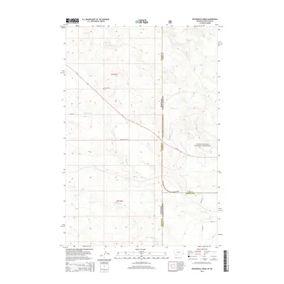
2014 Map of Waterhole Creek
USGS Topo · Published 2014About this map
Fertile Prairie Cem stands as a focal point for local heritage in this stretch of the High Plains, where the borders of Fallon County, Montana, and Slope and Bowman counties, North Dakota, meet. The landscape is defined by the expansive Little Missouri National Grassland, which dominates the eastern portion of the quadrangle. This open country is carved by a network of seasonal drainages, including Waterhole Cr, Buffalo Cr, and Corral Cr. Historically significant routes like Mink Trl and Buffalo Jump Trl intersect the area, suggesting long-standing travel corridors through the plains. The modern corridor of Us-12 cuts diagonally across the terrain, linking the scattered prairie landmarks and providing the primary access through this remote borderland region.
Find a feature on this map
19 named features on this map. Tap any name to fly to it.
Don’t see what you’re looking for? This feature index may not catch every label — zoom into the map to look around manually.
Map Details
Editions of this 2014 Waterhole Creek Map
This is the sole edition of this map. No revisions or reprints were ever made.
Other maps of this area

1953 · Miles City
USGS Topo · 1:250,000

1953 · Dickinson
USGS Topo · 1:250,000

1957 · Dickinson
USGS Topo · 1:250,000

1957 · Miles City
USGS Topo · 1:250,000

1958 · Miles City
USGS Topo · 1:250,000

1973 · Kid Creek
USGS Topo · 1:24,000

1980 · Pretty Butte
USGS Topo · 1:24,000

1980 · Marmarth
USGS Topo · 1:24,000

1981 · Webster NW
USGS Topo · 1:24,000

1981 · Baker
USGS Topo · 1:100,000