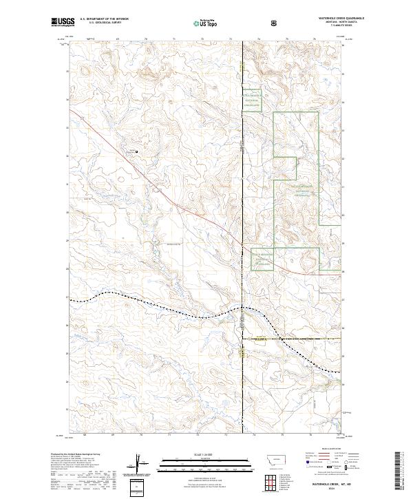
2024 Map of Waterhole Creek
USGS Topo · Published 2024About this map
The high plains along the Montana and North Dakota border are defined here by a network of drainage systems including Waterhole Creek and Buffalo Creek. This landscape in Fallon and Bowman counties reveals a pattern of modern land management alongside early rural markers. The Little Missouri National Grassland dominates the eastern portion of the map, preserving a significant stretch of the regional shortgrass prairie.
Find a feature on this map
18 named features on this map. Tap any name to fly to it.
Don’t see what you’re looking for? This feature index may not catch every label — zoom into the map to look around manually.
Map Details
Editions of this 2024 Waterhole Creek Map
This is the sole edition of this map. No revisions or reprints were ever made.
Other maps of this area

1953 · Miles City
USGS Topo · 1:250,000

1953 · Dickinson
USGS Topo · 1:250,000

1957 · Dickinson
USGS Topo · 1:250,000

1957 · Miles City
USGS Topo · 1:250,000

1958 · Miles City
USGS Topo · 1:250,000

1973 · Kid Creek
USGS Topo · 1:24,000

1980 · Pretty Butte
USGS Topo · 1:24,000

1980 · Marmarth
USGS Topo · 1:24,000

1981 · Webster NW
USGS Topo · 1:24,000

1981 · Baker
USGS Topo · 1:100,000