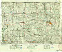
1955 Map of Waterloo
USGS Topo · Published 1955About this map
The Waterloo and Cedar Falls industrial hubs anchor this mid-century portrait of North Central Iowa, a landscape defined by the intricate convergence of the Cedar River, Iowa River, and Shell Rock River. Compiled just before the expansion of the modern interstate system, the map reveals a dense grid of section lines and gravel roads supporting a network of farm-to-market towns like Hampton, Clarion, and Grundy Center.
Find a feature on this map
262 named features on this map. Tap any name to fly to it.
Don’t see what you’re looking for? This feature index may not catch every label — zoom into the map to look around manually.
Map Details
Editions of this 1955 Waterloo Map
2 editions found

Other maps of this area

1888 · Shellsburg
USGS Topo · 1:62,500

1888 · Amana
USGS Topo · 1:62,500

1889 · Amana
USGS Topo · 1:62,500

1889 · Shellsburg
USGS Topo · 1:62,500

1899 · Amana
USGS Topo · 1:62,500

1899 · Shellsburg
USGS Topo · 1:62,500

1901 · Oelwein
USGS Topo · 1:125,000

1903 · Fairfax
USGS Topo · 1:125,000

1903 · Winthrop
USGS Topo · 1:125,000

1906 · Decorah
USGS Topo · 1:125,000