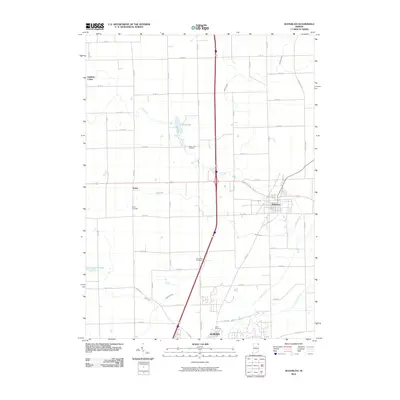
2010 Map of Waterloo
USGS Topo · Published 2010About this map
Waterloo and the northern reaches of Auburn anchor this DeKalb County landscape, where the agricultural grid is defined by an extensive network of drainage infrastructure. The map illustrates how the natural hydrology of Cedar Lake and Cedar Creek has been supplemented by numerous named channels, including Leins Ditch, Swartz Ditch, and Peckhart Ditch, reflecting the region's long history of land management for farming. Small unincorporated settlements like Sedan and Fairfield Center persist along the county road system, preserving the rural character of the era.
Find a feature on this map
49 named features on this map. Tap any name to fly to it.
Don’t see what you’re looking for? This feature index may not catch every label — zoom into the map to look around manually.
Map Details
Editions of this 2010 Waterloo Map
This is the sole edition of this map. No revisions or reprints were ever made.
Other maps of this area

1939 · Hamilton
USGS Topo · 1:24,000

1942 · Ashley
USGS Topo · 1:24,000

1942 · Stroh
USGS Topo · 1:24,000

1948 · Hamilton
USGS Topo · 1:24,000

1953 · Fort Wayne
USGS Topo · 1:250,000

1955 · Corunna
USGS Topo · 1:24,000

1956 · Fort Wayne
USGS Topo · 1:250,000

1957 · Auburn
USGS Topo · 1:24,000

1957 · Waterloo
USGS Topo · 1:24,000

1957 · Garrett
USGS Topo · 1:24,000