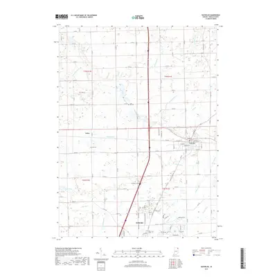
2019 Map of Waterloo
USGS Topo · Published 2019About this map
Waterloo and the northern edge of Auburn anchor this portion of DeKalb County, revealing a landscape deeply defined by its drainage and irrigation networks. The territory is crisscrossed by numerous managed waterways such as McCullough Ditch, Dibbling Ditch, and Swartz Ditch, which support the agricultural tracts between the settlements. This network reflects the transition from natural wetlands to productive farmland, punctuated by small glacial remnants like Cedar Lake and Lintz Lake. Along the periphery of the town centers, several local burial grounds including Cedar Lake Cem, Tamarack Cem, and Sedan Cem provide specific points of interest for genealogists tracking family history in the area around the small hamlet of Sedan. The arrival of modern infrastructure is evident in the layout of the Industrial Pkwy corridor and the grid of county roads that formalize the township boundaries of T35N and T34N.
Find a feature on this map
86 named features on this map. Tap any name to fly to it.
Don’t see what you’re looking for? This feature index may not catch every label — zoom into the map to look around manually.
Map Details
Editions of this 2019 Waterloo Map
This is the sole edition of this map. No revisions or reprints were ever made.
Other maps of this area

1939 · Hamilton
USGS Topo · 1:24,000

1942 · Ashley
USGS Topo · 1:24,000

1942 · Stroh
USGS Topo · 1:24,000

1948 · Hamilton
USGS Topo · 1:24,000

1953 · Fort Wayne
USGS Topo · 1:250,000

1955 · Corunna
USGS Topo · 1:24,000

1956 · Fort Wayne
USGS Topo · 1:250,000

1957 · Auburn
USGS Topo · 1:24,000

1957 · Waterloo
USGS Topo · 1:24,000

1957 · Garrett
USGS Topo · 1:24,000