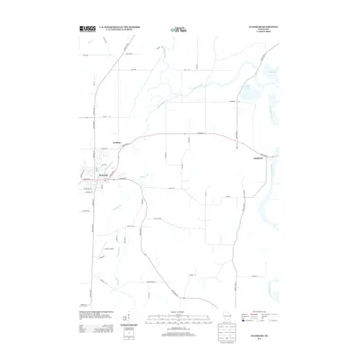
2013 Map of Waterloo
USGS Topo · Published 2013About this map
The Maunesha River winds through the heart of this Jefferson County landscape, connecting the primary settlements of Waterloo and Portland. This region is defined by its complex hydrography, where the Crawfish River feeds into both Chub Lake and Mud Lake along the eastern edge of the quadrangle. The agricultural character of the area is evident in the dense network of local roads such as Hubbleton Rd, Island Rd, and Waterloo Rd, which link scattered farmsteads and rural residences to the larger corridors of State Road 19 and State Road 89. Just south of the Waterloo town center, Tesmer Airport serves as a distinct local landmark near the winding path of Stony Brook. The map details the transition from small-town street grids, like those along W Madison St and Milwaukee Ave, to the broad glacial drainage patterns that have historically shaped the Wisconsin countryside.
Find a feature on this map
55 named features on this map. Tap any name to fly to it.
Don’t see what you’re looking for? This feature index may not catch every label — zoom into the map to look around manually.
Map Details
Editions of this 2013 Waterloo Map
This is the sole edition of this map. No revisions or reprints were ever made.
Other maps of this area

1890 · Sun Prairie
USGS Topo · 1:62,500

1891 · Waterloo
USGS Topo · 1:62,500

1894 · Waterloo
USGS Topo · 1:62,500

1896 · Sun Prairie
USGS Topo · 1:62,500

1905 · Sun Prairie
USGS Topo · 1:62,500

1907 · Sun Prairie
USGS Topo · 1:62,500

1910 · Waterloo
USGS Topo · 1:62,500

1955 · Columbus
USGS Topo · 1:62,500

1955 · Beaver Dam
USGS Topo · 1:62,500

1957 · Madison
USGS Topo · 1:250,000