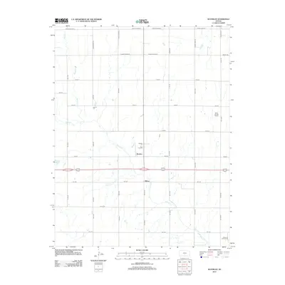
2012 Map of Waterloo
USGS Topo · Published 2012About this map
Smoots Cr and Spring Cr meander through this section of Kingman County, shaping a rural landscape defined by agricultural section lines and small community centers. The settlement of Waterloo serves as a central point, flanked by the Waterloo Cem and Saint Louis Cem, which provide significant touchpoints for local genealogical research. To the north, Lebanon Cem sits isolated among the fields, marking an earlier era of neighborhood burial grounds. The presence of the Mono Aircraft Airport and the Dewey Oil and Gas Field in the southeast corner indicates the diverse economic activities of the region, from private aviation to energy extraction. A strictly gridded road network, including routes like W Maple Grove Rd and S Broadacres Rd, connects these disparate points across the Kansas plains.
Find a feature on this map
39 named features on this map. Tap any name to fly to it.
Don’t see what you’re looking for? This feature index may not catch every label — zoom into the map to look around manually.
Map Details
Editions of this 2012 Waterloo Map
This is the sole edition of this map. No revisions or reprints were ever made.
Other maps of this area

1889 · Cheney
USGS Topo · 1:125,000

1891 · Cheney
USGS Topo · 1:125,000

1892 · Kingman
USGS Topo · 1:125,000

1894 · Kingman
USGS Topo · 1:125,000

1901 · Cheney
USGS Topo · 1:125,000

1955 · Wichita
USGS Topo · 1:250,000

1955 · Pratt
USGS Topo · 1:250,000

1958 · Wichita
USGS Topo · 1:250,000

1959 · Pratt
USGS Topo · 1:250,000

1964 · Cheney
USGS Topo · 1:24,000