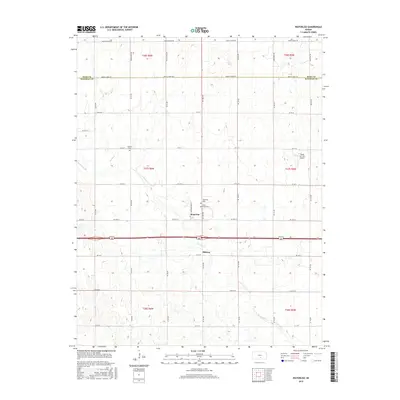
2015 Map of Waterloo
USGS Topo · Published 2015About this map
Smoots Cr meanders through the heart of this landscape, tracing the border between Kingman and Reno counties. The settlement of Waterloo serves as a central point, anchored by the Waterloo Cem and Saint Louis Cem. The map reveals a strictly organized grid of agricultural roads, including NE 100 Ave and NE 20 St, which connect the small community of Midway to the surrounding prairie. To the west, Spring Cr flows toward the county line near the Lebanon Cem, while the far eastern edge is marked by the Mono Aircraft Airport. This survey provides a clear view of the modern rural infrastructure in south-central Kansas, illustrating how early township divisions like t27s r6w have evolved into a landscape of family farms and local cemeteries.
Find a feature on this map
40 named features on this map. Tap any name to fly to it.
Don’t see what you’re looking for? This feature index may not catch every label — zoom into the map to look around manually.
Map Details
Editions of this 2015 Waterloo Map
This is the sole edition of this map. No revisions or reprints were ever made.
Other maps of this area

1889 · Cheney
USGS Topo · 1:125,000

1891 · Cheney
USGS Topo · 1:125,000

1892 · Kingman
USGS Topo · 1:125,000

1894 · Kingman
USGS Topo · 1:125,000

1901 · Cheney
USGS Topo · 1:125,000

1955 · Wichita
USGS Topo · 1:250,000

1955 · Pratt
USGS Topo · 1:250,000

1958 · Wichita
USGS Topo · 1:250,000

1959 · Pratt
USGS Topo · 1:250,000

1964 · Cheney
USGS Topo · 1:24,000