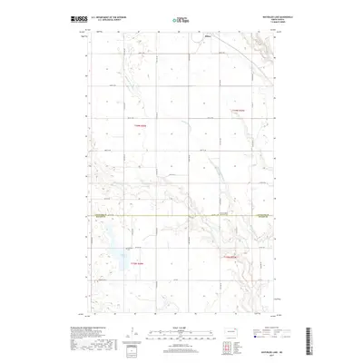
2017 Map of Waterloo Lake
USGS Topo · Published 2017About this map
Milton sits at the northern edge of this high plains landscape, where the geography is defined by the branching headwaters of the Park River system. The terrain transitions across the Cavalier Co Walsh Co boundary, marked by a series of winding seasonal waterways including the N Br Park River, Middle Br Park River, and S Br Park River. These drainage patterns converge toward the southeast, eventually leading toward Waterloo Lake. The map reveals a deeply established rural grid system of section lines and roads such as Co Hwy 1, interspersed with sites of local heritage. Significant landmarks for genealogical research include the Saint Stephens Lutheran Cem and Hitterdal Cem, which serve as quiet anchors for the farming communities that have long managed these North Dakota townships.
Find a feature on this map
22 named features on this map. Tap any name to fly to it.
Don’t see what you’re looking for? This feature index may not catch every label — zoom into the map to look around manually.
Map Details
Editions of this 2017 Waterloo Lake Map
This is the sole edition of this map. No revisions or reprints were ever made.
Other maps of this area

1952 · Thief River Falls
USGS Topo · 1:250,000

1953 · Devils Lake
USGS Topo · 1:250,000

1956 · Thief River Falls
USGS Topo · 1:250,000

1956 · Devils Lake
USGS Topo · 1:250,000

1957 · Thief River Falls
USGS Topo · 1:250,000
1964 · Concrete
USGS Topo · 1:24,000

1967 · Thief River Falls
USGS Topo · 1:250,000

1972 · Osnabrock
USGS Topo · 1:24,000
1972 · Milton
USGS Topo · 1:24,000

1972 · Osnabrock SW
USGS Topo · 1:24,000