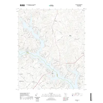
2020 Map of Waterloo
USGS Topo · Published 2020About this map
Lake Greenwood dominates the southern half of this landscape, its intricate fingers reaching into both Laurens and Greenwood counties. The settlement of Waterloo sits north of the water, positioned along the central transit corridor that links the rural uplands to the growing residential areas around Lake Shores and Lota. The map reveals a transition from traditional agricultural and timber lands to modern lakeside development, while still preserving older landmarks such as Boyds Bridge and Ridgewood Air.
Find a feature on this map
165 named features on this map. Tap any name to fly to it.
Don’t see what you’re looking for? This feature index may not catch every label — zoom into the map to look around manually.
Map Details
Editions of this 2020 Waterloo Map
This is the sole edition of this map. No revisions or reprints were ever made.
Other maps of this area

1892 · Abbeville
USGS Topo · 1:125,000

1941 · Spartanburg
USGS Topo · 1:250,000

1949 · Ninety-Six
USGS Topo · 1:24,000

1949 · Greenwood
USGS Topo · 1:24,000

1953 · Spartanburg
USGS Topo · 1:250,000

1954 · Greenville
USGS Topo · 1:250,000

1958 · Greenville
USGS Topo · 1:250,000

1960 · Spartanburg
USGS Topo · 1:250,000

1963 · Spartanburg
USGS Topo · 1:250,000

1964 · Spartanburg
USGS Topo · 1:250,000