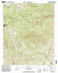
1995 Map of Waterman Mountain
USGS Topo · Published 1999About this map
Angeles Crest Highway serves as the primary artery through this high-altitude section of the Angeles National Forest, providing access to numerous mountain retreats and recreation sites during the mid-1990s. The map illustrates a concentration of group facilities such as Camp Christian, Camp Singing Pines, and Camp Cumorah Crest near the settlement of Three Points. Winter sports are a central theme of the local landscape, represented by the Mt Waterman Ski Area and Snowcrest Ski Area on the slopes of Waterman Mountain. For wilderness researchers, the map traces the Pacific Crest National Scenic Trail as it winds through the northern ridges and shows the rugged isolation of the San Gabriel Wilderness. The presence of remote landmarks like Louies Cabin and various trail camps, including Upper Bear Trail Camp, highlights the area's role as a destination for backcountry exploration away from the Los Angeles basin.
Find a feature on this map
50 named features on this map. Tap any name to fly to it.
Don’t see what you’re looking for? This feature index may not catch every label — zoom into the map to look around manually.
Map Details
Editions of this 1995 Waterman Mountain Map
This is the sole edition of this map. No revisions or reprints were ever made.
Other maps of this area

1894 · Los Angeles
USGS Topo · 1:62,500

1894 · Pomona
USGS Topo · 1:62,500

1896 · Pasadena
USGS Topo · 1:62,500

1897 · Pomona
USGS Topo · 1:62,500

1898 · Pomona
USGS Topo · 1:62,500

1900 · Pasadena
USGS Topo · 1:62,500

1900 · Tujunga
USGS Topo · 1:62,500

1900 · Los Angeles
USGS Topo · 1:62,500

1901 · Southern California Sheet No. 1
USGS Topo · 1:250,000

1903 · Rock Creek
USGS Topo · 1:62,500