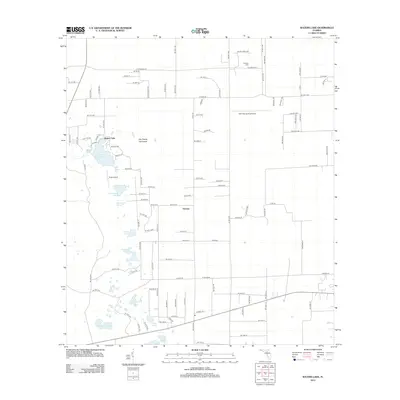
2012 Map of Waters Lake
USGS Topo · Published 2012About this map
Waters Lake and the small settlement of Thames anchor this section of Alachua County, Florida, where the karst landscape creates a dense cluster of ponds and small lakes. This area is characterized by localized water bodies such as Christmas Lake, Camp Pond, and the family-named Knighting Lake and Jeb Knight Pond. These features reflect the unique hydrology of the North Florida interior, where limestone-based depressions capture surface water to form permanent and semi-permanent basins.
Find a feature on this map
107 named features on this map. Tap any name to fly to it.
Don’t see what you’re looking for? This feature index may not catch every label — zoom into the map to look around manually.
Map Details
Editions of this 2012 Waters Lake Map
This is the sole edition of this map. No revisions or reprints were ever made.
Other maps of this area

1954 · Gainesville
USGS Topo · 1:250,000

1958 · Gainesville
USGS Topo · 1:250,000

1959 · Gainesville
USGS Topo · 1:250,000

1962 · High Springs
USGS Topo · 1:24,000

1968 · Newberry SW
USGS Topo · 1:24,000

1968 · Waters Lake
USGS Topo · 1:24,000
1968 · Archer
USGS Topo · 1:24,000

1968 · Newberry
USGS Topo · 1:24,000

1968 · Fourmile Lake
USGS Topo · 1:24,000

1968 · Trenton
USGS Topo · 1:24,000