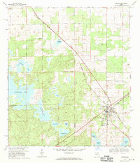
1968 Map of Archer
USGS Topo · Published 1970About this map
The town of Archer sits at a critical junction of the Seaboard Coast Line railroad in the late 1960s, serving as a hub for the surrounding Alachua and Levy County borderlands. The landscape is defined by an intricate network of karst solution depressions, creating a series of named water bodies such as Watermelon Pond, Half Moon Pond, and Blue Pete Lake. The settlement patterns here are deeply rooted in community institutions, evidenced by the cluster of local landmarks including the Archer Community Sch, Laurel Hill Cem, and several rural houses of worship like Shiloh Ch and St Pauls Ch. A small residential pocket at Pinesville and the presence of a Lookout Tower reflect the area's mix of small-town life and forestry management. The topography is exceptionally detailed, showing the subtle elevation changes that characterize this part of North Central Florida's interior.
Find a feature on this map
27 named features on this map. Tap any name to fly to it.
Don’t see what you’re looking for? This feature index may not catch every label — zoom into the map to look around manually.
Map Details
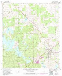
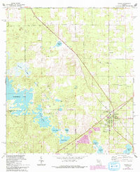
Editions of this 1968 Archer Map
3 editions found
Other maps of this area

1890 · Arredondo
USGS Topo · 1:62,500

1892 · Arredondo
USGS Topo · 1:62,500

1894 · Arredondo
USGS Topo · 1:62,500

1895 · Williston
USGS Topo · 1:62,500

1954 · Bronson
USGS Topo · 1:24,000

1954 · Gainesville
USGS Topo · 1:250,000

1955 · Bronson NE
USGS Topo · 1:24,000

1958 · Gainesville
USGS Topo · 1:250,000

1959 · Gainesville
USGS Topo · 1:250,000

1966 · Gainesville West
USGS Topo · 1:24,000