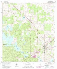
1968 Map of Archer
USGS Topo · Published 1988About this map
Archer serves as the primary hub on this map, showing a dense grid of streets and landmarks just as the area was being photorevised in the late 1980s. The landscape is defined by its numerous water bodies, ranging from the expansive Watermelon Pond in the west to smaller, family-named features like Gosman Pond, Parchman Pond, and Jake White Pond. This geography, characterized by scattered ponds and lakes, heavily influenced local settlement patterns, pushing development toward higher ground near the Archer Community Sch and the surrounding neighborhoods.
Find a feature on this map
27 named features on this map. Tap any name to fly to it.
Don’t see what you’re looking for? This feature index may not catch every label — zoom into the map to look around manually.
Map Details
Editions of this 1968 Archer Map
3 editions found
Other maps of this area

1890 · Arredondo
USGS Topo · 1:62,500

1892 · Arredondo
USGS Topo · 1:62,500

1894 · Arredondo
USGS Topo · 1:62,500

1895 · Williston
USGS Topo · 1:62,500

1954 · Bronson
USGS Topo · 1:24,000

1954 · Gainesville
USGS Topo · 1:250,000

1955 · Bronson NE
USGS Topo · 1:24,000

1958 · Gainesville
USGS Topo · 1:250,000

1959 · Gainesville
USGS Topo · 1:250,000

1966 · Gainesville West
USGS Topo · 1:24,000