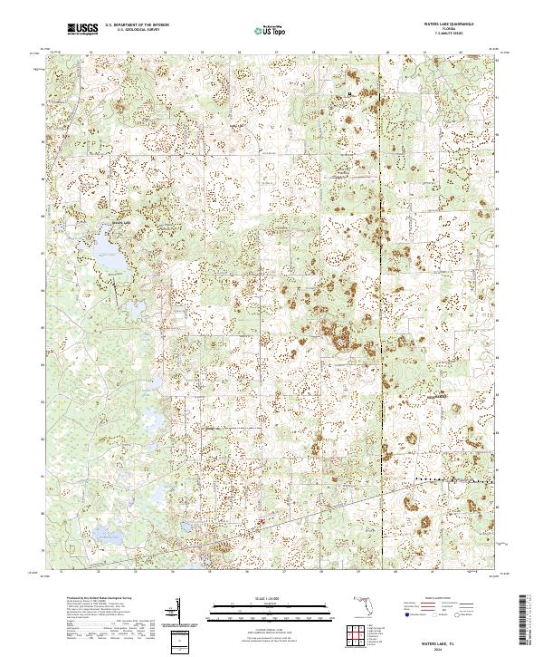
2024 Map of Waters Lake
USGS Topo · Published 2024About this map
Waters Lake and its surrounding wetlands dominate this pocket of the Florida landscape along the border of Gilchrist and Alachua Counties. The terrain is defined by a dense network of scattered ponds and hammocks, including Dry Prairie Hammock and Bogg Pond, illustrating the intricate local hydrology. The eastern edge of the map shows the outskirts of Newberry, while the rural interior is dotted with small-scale landings and family-named landmarks like Jeb Knight Pond and Knighting Lake.
Find a feature on this map
60 named features on this map. Tap any name to fly to it.
Don’t see what you’re looking for? This feature index may not catch every label — zoom into the map to look around manually.
Map Details
Editions of this 2024 Waters Lake Map
This is the sole edition of this map. No revisions or reprints were ever made.
Other maps of this area

1954 · Gainesville
USGS Topo · 1:250,000

1958 · Gainesville
USGS Topo · 1:250,000

1959 · Gainesville
USGS Topo · 1:250,000

1962 · High Springs
USGS Topo · 1:24,000

1968 · Newberry SW
USGS Topo · 1:24,000

1968 · Waters Lake
USGS Topo · 1:24,000
1968 · Archer
USGS Topo · 1:24,000

1968 · Newberry
USGS Topo · 1:24,000

1968 · Fourmile Lake
USGS Topo · 1:24,000

1968 · Trenton
USGS Topo · 1:24,000