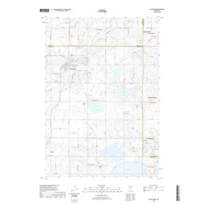
2019 Map of Watertown
USGS Topo · Published 2019About this map
The South Fork Crow River carves a winding path through this western Twin Cities periphery, anchoring the established community of Watertown. This area, where Wright, Carver, and Hennepin counties meet, is characterized by a dense network of glacial lakes and wetlands, including the prominent Swede Lake, Mud Lake, and the northern reaches of Lake Waconia. The landscape is dotted with centers of early local life, from the village of St. Bonifacius to the smaller settlement of Mayer. Genealogists will find significant value in the documentation of local burial grounds such as Saint Paul's Catholic Cem, Trinity Cem, and Swede Lake Cem, which speak to the area's diverse religious and immigrant heritage. The map also traces the transition of rural townships like Independence as they integrated into the expanding regional infrastructure via routes like Co Hwy 16 and Watertown Rd.
Find a feature on this map
122 named features on this map. Tap any name to fly to it.
Don’t see what you’re looking for? This feature index may not catch every label — zoom into the map to look around manually.
Map Details
Editions of this 2019 Watertown Map
This is the sole edition of this map. No revisions or reprints were ever made.
Other maps of this area

1905 · Minnetonka
USGS Topo · 1:62,500

1907 · Minnetonka
USGS Topo · 1:62,500

1909 · Rockford
USGS Topo · 1:62,500

1953 · Saint Paul
USGS Topo · 1:250,000

1953 · Stillwater
USGS Topo · 1:250,000

1955 · Stillwater
USGS Topo · 1:250,000

1957 · Waconia
USGS Topo · 1:62,500

1958 · Stillwater
USGS Topo · 1:250,000

1958 · Victoria
USGS Topo · 1:24,000

1958 · Rockford
USGS Topo · 1:62,500