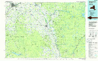
1985 Map of Watertown
USGS Topo · Published 1986About this map
The Black River serves as the industrial and geographic spine of this Northern New York region, flowing from the edge of the Adirondack Park through Lowville and Carthage before reaching the urban center at Watertown. This mid-1980s planimetric survey captures the distinct transition between the agricultural Black River Valley and the heavy timberlands of the Adirondacks. To the east, the Fulton Chain of Lakes and the sprawling Stillwater Reservoir define a landscape of recreation and conservation, while the western portion is dominated by the high, snow-prone plateau of Tug Hill.
Find a feature on this map
88 named features on this map. Tap any name to fly to it.
Don’t see what you’re looking for? This feature index may not catch every label — zoom into the map to look around manually.
Map Details
Editions of this 1985 Watertown Map
2 editions found
Other maps of this area

1893 · Sackets Harbor
USGS Topo · 1:62,500

1895 · Sacketts Harbor
USGS Topo · 1:62,500

1895 · Pulaski
USGS Topo · 1:62,500

1895 · Watertown
USGS Topo · 1:62,500

1897 · Remsen
USGS Topo · 1:62,500

1898 · Watertown
USGS Topo · 1:62,500

1900 · Remsen
USGS Topo · 1:62,500

1900 · Wilmurt
USGS Topo · 1:62,500

1900 · Clayton
USGS Topo · 1:62,500

1901 · Old Forge
USGS Topo · 1:62,500