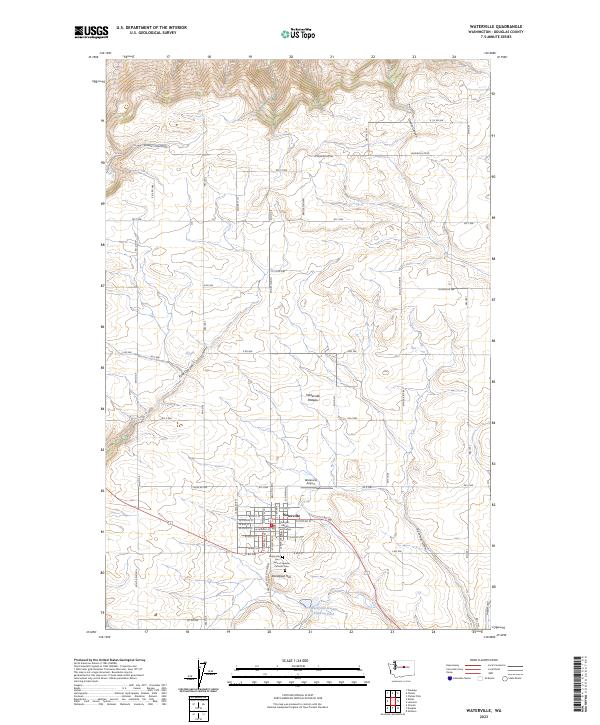
2023 Map of Waterville
USGS Topo · Published 2023About this map
Waterville sits as the focal point of this modern survey, occupying a prominent position on the expansive Waterville Plateau. The town's grid is well-defined by streets such as W Poplar St and E Elm St, anchored by the historic Douglas County Courthouse. To the south, the local geography is shaped by Standpipe Hill and a pair of burial grounds: Waterville Cem and the Gate of Heaven Catholic Cem.
Find a feature on this map
43 named features on this map. Tap any name to fly to it.
Don’t see what you’re looking for? This feature index may not catch every label — zoom into the map to look around manually.
Map Details
Editions of this 2023 Waterville Map
This is the sole edition of this map. No revisions or reprints were ever made.
Other maps of this area

1901 · Chelan
USGS Topo · 1:125,000

1953 · Ritzville
USGS Topo · 1:250,000

1957 · Wenatchee
USGS Topo · 1:250,000

1959 · Ritzville
USGS Topo · 1:250,000

1965 · Ritzville
USGS Topo · 1:250,000

1968 · Chelan
USGS Topo · 1:24,000

1968 · Lamoine
USGS Topo · 1:24,000

1968 · Chelan Falls
USGS Topo · 1:24,000
1968 · Alstown
USGS Topo · 1:24,000

1968 · Orondo
USGS Topo · 1:24,000