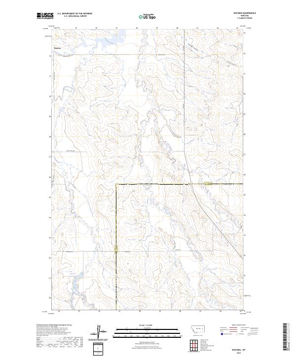
2024 Map of Watkins
USGS Topo · Published 2024About this map
The settlement of Watkins serves as the focal point of this high-plains landscape where the Redwater River and its numerous tributaries have carved a complex system of drainages through the terrain. The map details the rural infrastructure of eastern Montana, where life is organized around water sources and long-distance section-line roads. Water management is evident in the presence of the Lisk Cr Reservoir along Lisk Creek, reflecting the region's reliance on localized irrigation and livestock watering.
Find a feature on this map
21 named features on this map. Tap any name to fly to it.
Don’t see what you’re looking for? This feature index may not catch every label — zoom into the map to look around manually.
Map Details
Editions of this 2024 Watkins Map
This is the sole edition of this map. No revisions or reprints were ever made.
Other maps of this area

1954 · Glendive
USGS Topo · 1:250,000

1957 · Glendive
USGS Topo · 1:250,000

1958 · Glendive
USGS Topo · 1:250,000

1965 · Heitz School
USGS Topo · 1:24,000

1965 · Watkins SE
USGS Topo · 1:24,000

1965 · Watkins
USGS Topo · 1:24,000
1965 · Berry School
USGS Topo · 1:24,000

1982 · Circle
USGS Topo · 1:100,000
1983 · Big Sheep Mountain
USGS Topo · 1:24,000
1983 · Brockway
USGS Topo · 1:24,000