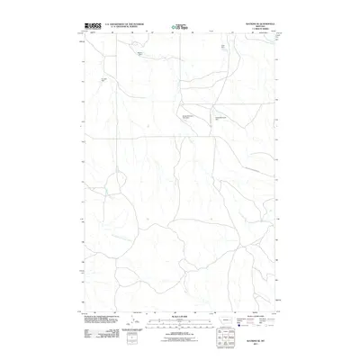
2011 Map of Watkins SE
USGS Topo · Published 2011About this map
Redwater River flows through this corner of McCone County, Montana, carving a course through an arid landscape defined by small-scale water management. The topography is marked by numerous stock ponds and water control structures, including the curiously named For Sale Dam and Wackle Dam. These features, along with Duck Dam and Sheep Mountain Dam, speak to the critical importance of water storage for ranching operations in this high plains environment.
Find a feature on this map
12 named features on this map. Tap any name to fly to it.
Don’t see what you’re looking for? This feature index may not catch every label — zoom into the map to look around manually.
Map Details
Editions of this 2011 Watkins SE Map
This is the sole edition of this map. No revisions or reprints were ever made.
Other maps of this area

1953 · Miles City
USGS Topo · 1:250,000

1954 · Glendive
USGS Topo · 1:250,000

1957 · Miles City
USGS Topo · 1:250,000

1957 · Glendive
USGS Topo · 1:250,000

1958 · Miles City
USGS Topo · 1:250,000

1958 · Glendive
USGS Topo · 1:250,000

1965 · Little Sheep Mountain
USGS Topo · 1:24,000

1965 · Heitz School
USGS Topo · 1:24,000
1965 · Combs Ranch
USGS Topo · 1:24,000

1965 · Watkins SE
USGS Topo · 1:24,000