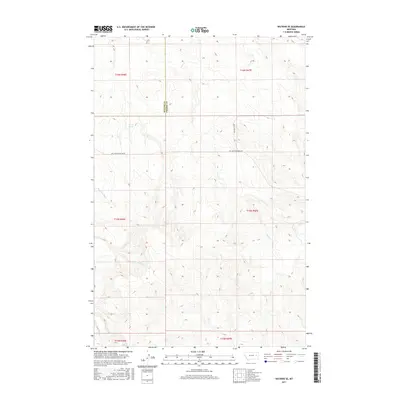
2017 Map of Watkins SE
USGS Topo · Published 2017About this map
Redwater River winds through the southwestern corner of this high-plains landscape, where the boundary between McCone County and Prairie County splits the drainage basins. This 2017 survey reveals an area defined by its seasonal watercourses and extensive section-line tracks. To the north, Lisk Cr carves a path toward the hills, while the centrally located Morton Spring provides a rare perennial water source in this arid terrain. The map documents the network of rural infrastructure supporting local land use, notably Big Sheep Mountain Rd and Duck Creek Rd. These routes provide access to the upper reaches of Timber Cr and its eastern branch, E Br Timber Cr, illustrating how modern ranching and transit corridors follow the natural topography of the eastern Montana coulees.
Find a feature on this map
14 named features on this map. Tap any name to fly to it.
Don’t see what you’re looking for? This feature index may not catch every label — zoom into the map to look around manually.
Map Details
Editions of this 2017 Watkins SE Map
This is the sole edition of this map. No revisions or reprints were ever made.
Other maps of this area

1953 · Miles City
USGS Topo · 1:250,000

1954 · Glendive
USGS Topo · 1:250,000

1957 · Miles City
USGS Topo · 1:250,000

1957 · Glendive
USGS Topo · 1:250,000

1958 · Miles City
USGS Topo · 1:250,000

1958 · Glendive
USGS Topo · 1:250,000

1965 · Little Sheep Mountain
USGS Topo · 1:24,000

1965 · Heitz School
USGS Topo · 1:24,000
1965 · Combs Ranch
USGS Topo · 1:24,000

1965 · Watkins SE
USGS Topo · 1:24,000