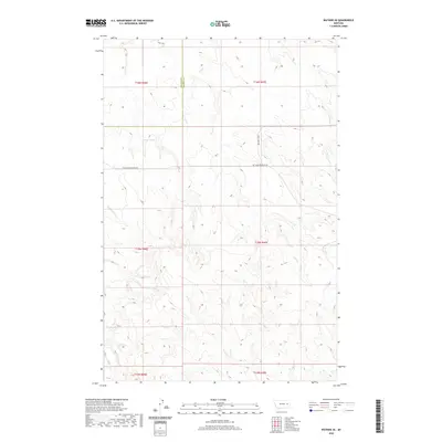
2020 Map of Watkins SE
USGS Topo · Published 2020About this map
The boundary line between McCone Co and Prairie Co cuts through this high-plains landscape, where the headwaters of several drainage systems originate. The Redwater River flows through the western portion of the terrain, while the eastern section is defined by the winding course of Lisk Cr. Water sources are critical in this arid region, as evidenced by the marking of Morton Spring north of Big Sheep Mountain Rd. The map illustrates a sparse network of section lines and range roads, including Duck Creek Rd, that facilitate travel between remote ranching tracts. Topographical detail reveals the complex network of draws feeding into Timber Cr and the E Br Timber Cr, showcasing the natural erosion patterns that define the Eastern Montana breaks.
Find a feature on this map
14 named features on this map. Tap any name to fly to it.
Don’t see what you’re looking for? This feature index may not catch every label — zoom into the map to look around manually.
Map Details
Editions of this 2020 Watkins SE Map
This is the sole edition of this map. No revisions or reprints were ever made.
Other maps of this area

1953 · Miles City
USGS Topo · 1:250,000

1954 · Glendive
USGS Topo · 1:250,000

1957 · Miles City
USGS Topo · 1:250,000

1957 · Glendive
USGS Topo · 1:250,000

1958 · Miles City
USGS Topo · 1:250,000

1958 · Glendive
USGS Topo · 1:250,000

1965 · Little Sheep Mountain
USGS Topo · 1:24,000

1965 · Heitz School
USGS Topo · 1:24,000
1965 · Combs Ranch
USGS Topo · 1:24,000

1965 · Watkins SE
USGS Topo · 1:24,000