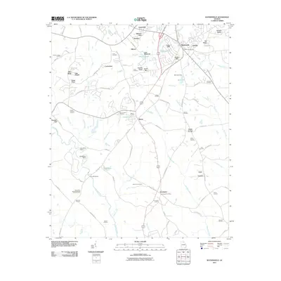
2011 Map of Watkinsville
USGS Topo · Published 2011About this map
Watkinsville serves as the focal point of this Oconee County landscape, exhibiting the residential expansion of communities like Harden Hills and Cedar Hills at the start of the 21st century. The map provides significant genealogical value through its preservation of numerous family-named burial grounds, including the Fullilove-Jackson Cemetery, Sheets-Thompson Cemetery, and Klutts Cemetery. To the south, the village of Farmington remains a distinct marker of the local rail and road network, anchored by its own Farmington Post Office.
Find a feature on this map
104 named features on this map. Tap any name to fly to it.
Don’t see what you’re looking for? This feature index may not catch every label — zoom into the map to look around manually.
Map Details
Editions of this 2011 Watkinsville Map
This is the sole edition of this map. No revisions or reprints were ever made.
Other maps of this area

1896 · Monroe
USGS Topo · 1:125,000

1953 · Athens
USGS Topo · 1:250,000

1958 · Athens
USGS Topo · 1:250,000

1959 · Athens
USGS Topo · 1:250,000

1963 · Athens
USGS Topo · 1:250,000

1964 · Athens West
USGS Topo · 1:24,000

1964 · Barnett Shoals
USGS Topo · 1:24,000

1964 · High Shoals
USGS Topo · 1:24,000

1964 · Watkinsville
USGS Topo · 1:24,000
1964 · Statham
USGS Topo · 1:24,000