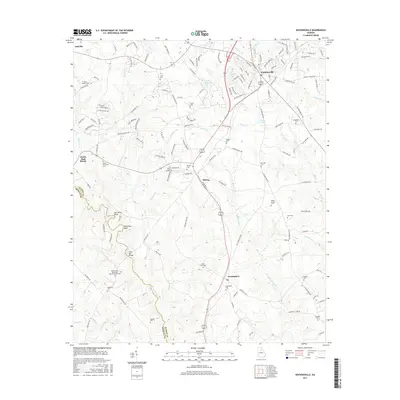
2017 Map of Watkinsville
USGS Topo · Published 2017About this map
The Apalachee River carves a winding path along the western boundary of this Oconee County landscape, forming dramatic features like Gun Point Bend and Horseshoe Bend. The area is anchored by the historic seat of Watkinsville in the northeast, where the transition from residential streets to the surrounding countryside is marked by numerous family and community burial grounds. These include the Fullilove-Jackson Cem, Union Cem, and Hardigree Cem, which offer significant data points for genealogical research.
Find a feature on this map
151 named features on this map. Tap any name to fly to it.
Don’t see what you’re looking for? This feature index may not catch every label — zoom into the map to look around manually.
Map Details
Editions of this 2017 Watkinsville Map
This is the sole edition of this map. No revisions or reprints were ever made.
Other maps of this area

1896 · Monroe
USGS Topo · 1:125,000

1953 · Athens
USGS Topo · 1:250,000

1958 · Athens
USGS Topo · 1:250,000

1959 · Athens
USGS Topo · 1:250,000

1963 · Athens
USGS Topo · 1:250,000

1964 · Athens West
USGS Topo · 1:24,000

1964 · Barnett Shoals
USGS Topo · 1:24,000

1964 · High Shoals
USGS Topo · 1:24,000

1964 · Watkinsville
USGS Topo · 1:24,000
1964 · Statham
USGS Topo · 1:24,000