2024 Map of Watkinsville
USGS Topo · Published 2024About this map
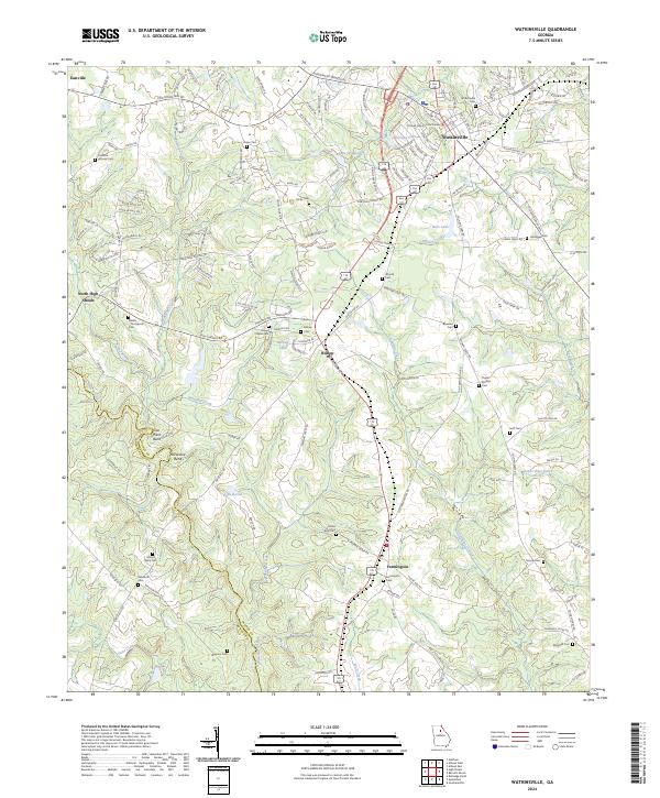
The Oconee County Courthouse stands as the central landmark of Watkinsville, the hub of a region defined by its dense network of small communities and family burial grounds. To the south, the settlements of Bishop and Farmington are linked by the transit corridor of the modern highway, while the Apalachee River and Oconee River carve the landscape into distinct basins. This modern survey reveals a high density of genealogical sites, including the Fullilove-Jackson Cem near Eastville and the Sheats-Thompson Cem further west. Water features like Lake Wildwood and Bells Lake punctuate the drainage basins of Porters Creek and Whitlow Creek. The transition from the rural outskirts near North High Shoals to the developed residential areas around Christian Lake illustrates the evolving character of Oconee County as it balances its agricultural roots with suburban expansion.
Find a feature on this map
138 named features on this map. Tap any name to fly to it.
Don’t see what you’re looking for? This feature index may not catch every label — zoom into the map to look around manually.
Map Details
Editions of this 2024 Watkinsville Map
This is the sole edition of this map. No revisions or reprints were ever made.