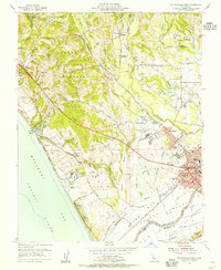
1954 Map of Watsonville West
USGS Topo · Published 1955About this map
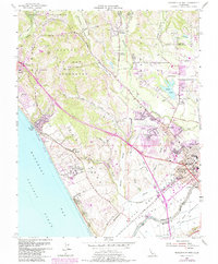
Watsonville serves as the bustling commercial heart of the coastal valley in the mid-1950s, its dense grid anchored by the City Hall, Auditorium, and numerous schools like Radcliff Sch and Notre Dame Academy. The surrounding landscape is a productive network of agriculture and infrastructure, where the Southern Pacific railroad lines connect small hubs like Freedom and Pajaro to the larger region. North of the city, the terrain transitions into the valleys of Laguna de las Calabasas and Day Valley, dotted with reservoirs and educational landmarks such as the Monte Vista Christian Sch. Along the coastline of Monterey Bay, the expansive campus of the Monterey Bay Academy and the residential clusters at La Selva Beach sit adjacent to the wetlands of Harkins Slough. The map captures a transition point between the intensive valley farming and the coastal bluffs of Sunset Beach State Park.
Find a feature on this map
68 named features on this map. Tap any name to fly to it.
Don’t see what you’re looking for? This feature index may not catch every label — zoom into the map to look around manually.
Map Details
Editions of this 1954 Watsonville West Map
6 editions found
Other maps of this area

1912 · Capitola
USGS Topo · 1:62,500

1914 · Capitola
USGS Topo · 1:62,500

1915 · San Juan Bautista
USGS Topo · 1:48,000

1916 · New Almaden
USGS Topo · 1:48,000

1917 · Morgan Hill
USGS Topo · 1:62,500

1917 · San Juan Bautista
USGS Topo · 1:62,500

1919 · New Almaden
USGS Topo · 1:62,500

1939 · Morgan Hill
USGS Topo · 1:62,500

1939 · San Juan Bautista
USGS Topo · 1:62,500

1940 · San Juan Bautista
USGS Topo · 1:62,500