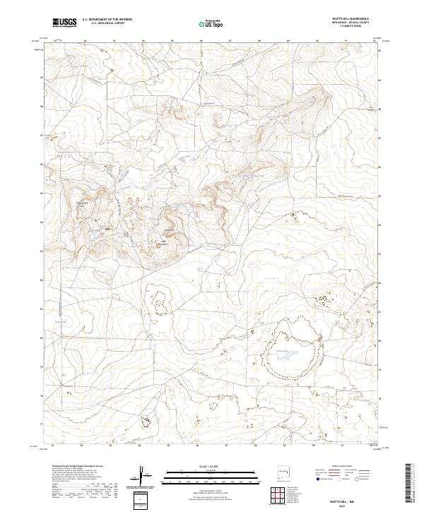
2023 Map of Watts Hill
USGS Topo · Published 2023About this map
Table Mountain and the prominent Watts Hill anchor this arid ranching landscape in De Baca County, where the scarcity of water is reflected in a network of named springs and stock tanks. The presence of Liberty School Rd and Round Mountain Rd hints at the area's rural development and the essential connections between scattered homesteads. Low-lying catchments like Alkali Lake and numerous engineered features such as Boven Spring Chimney Tank and Red Tank illustrate the historical efforts to manage local hydrology for livestock.
Find a feature on this map
39 named features on this map. Tap any name to fly to it.
Don’t see what you’re looking for? This feature index may not catch every label — zoom into the map to look around manually.
Map Details
Editions of this 2023 Watts Hill Map
This is the sole edition of this map. No revisions or reprints were ever made.
Other maps of this area

1954 · Fort Sumner
USGS Topo · 1:250,000

1954 · Clovis
USGS Topo · 1:250,000

1958 · Fort Sumner
USGS Topo · 1:250,000

1958 · Clovis
USGS Topo · 1:250,000

1967 · Eighteenmile Hill
USGS Topo · 1:24,000
1967 · Howell Ranch
USGS Topo · 1:24,000
1967 · Watts Hill
USGS Topo · 1:24,000
1967 · Cooley Lake
USGS Topo · 1:24,000

1968 · Lomas Gatos
USGS Topo · 1:24,000

1968 · Bonner Lake
USGS Topo · 1:24,000