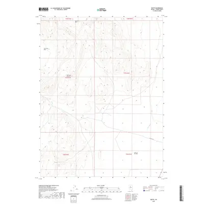
2018 Map of Watts
USGS Topo · Published 2018About this map
The Fish Creek Mountains dominate this high-desert landscape in central Nevada, carving out distinct geological depressions like Horseshoe Basin and Fish Creek Basin. This area is characterized by vast drainage patterns where seasonal waters such as Fish Cr descend from the peaks toward the eastern valley floor. To the south, the whimsical naming of the Valley of the Moon contrasts with the functional utility of Fish Creek Rd, which serves as a primary access point through the basin. The eastern edge of the quadrangle is defined by the Reese River, a vital watercourse in this arid region that historically influenced travel and land use. The map illustrates a stark, open terrain where township boundaries and sections provide the only formal structure across the expansive mountain and valley topography.
Find a feature on this map
13 named features on this map. Tap any name to fly to it.
Don’t see what you’re looking for? This feature index may not catch every label — zoom into the map to look around manually.
Map Details
Editions of this 2018 Watts Map
This is the sole edition of this map. No revisions or reprints were ever made.
Other maps of this area

1932 · Sonoma Range
USGS Topo · 1:250,000

1939 · Sonoma Range
USGS Topo · 1:250,000

1955 · Winnemucca
USGS Topo · 1:250,000

1958 · Winnemucca
USGS Topo · 1:250,000

1961 · McCoy
USGS Topo · 1:62,500

1961 · The Cedars
USGS Topo · 1:62,500

1961 · Mt. Moses
USGS Topo · 1:62,500

1962 · Winnemucca
USGS Topo · 1:250,000

1962 · Buffalo Springs
USGS Topo · 1:62,500

1982 · Fish Creek Mts
USGS Topo · 1:100,000