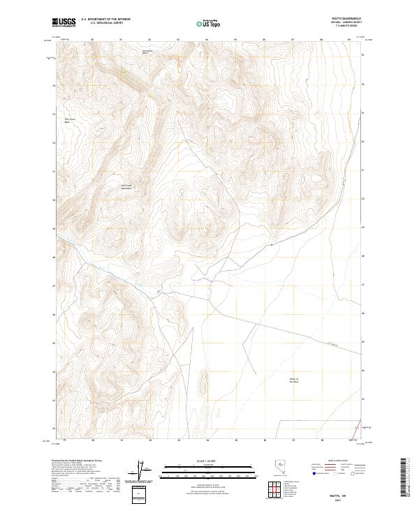
2021 Map of Watts
USGS Topo · Published 2021About this map
Fish Creek Mountains dominate this high-desert landscape in Lander County, defining a complex topography of drainage and elevation. The northern reaches are shaped by the Horseshoe Basin, while the western edge gives way to the broad Fish Creek Basin. This area is characterized by seasonal water flow, most notably along Fish Cr, which threads through the mountain canyons. Human imprint on this remote terrain is sparse, centered primarily on the lone corridor of Fish Creek Rd in the southeastern quadrant. To the south, the evocative Valley of the Moon offers a distinct geographic depression among the peaks, providing a clear example of the Great Basin's characteristic basin-and-range structure. This survey documents the intersection of public land survey sections and natural landforms in an area largely untouched by modern development.
Find a feature on this map
12 named features on this map. Tap any name to fly to it.
Don’t see what you’re looking for? This feature index may not catch every label — zoom into the map to look around manually.
Map Details
Editions of this 2021 Watts Map
This is the sole edition of this map. No revisions or reprints were ever made.
Other maps of this area

1932 · Sonoma Range
USGS Topo · 1:250,000

1939 · Sonoma Range
USGS Topo · 1:250,000

1955 · Winnemucca
USGS Topo · 1:250,000

1958 · Winnemucca
USGS Topo · 1:250,000

1961 · McCoy
USGS Topo · 1:62,500

1961 · The Cedars
USGS Topo · 1:62,500

1961 · Mt. Moses
USGS Topo · 1:62,500

1962 · Winnemucca
USGS Topo · 1:250,000

1962 · Buffalo Springs
USGS Topo · 1:62,500

1982 · Fish Creek Mts
USGS Topo · 1:100,000