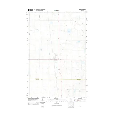
2013 Map of Waubun
USGS Topo · Published 2013About this map
Waubun serves as the central hub of this northern Minnesota landscape, situated at the intersection of Us-59 and MN-113. The settlement's local history is anchored by its Po and essential community sites such as Saint Anns Cem and Waubun Cem. The surrounding terrain is defined by a dense network of glacial water bodies, including Santwire Lake, Waubun Lake, and Fish Lake to the southeast. To the northeast, the White Earth River meanders across the plain, while Spring Cr drains the central corridor near the town site. The map also delineates the jurisdictional boundary between Mahnomen Co and Becker Co, providing a clear view of the rural road network that connects these remote lake-strewn lands through routes like Co HWY-6 and Mah Co 111.
Find a feature on this map
25 named features on this map. Tap any name to fly to it.
Don’t see what you’re looking for? This feature index may not catch every label — zoom into the map to look around manually.
Map Details
Editions of this 2013 Waubun Map
This is the sole edition of this map. No revisions or reprints were ever made.
Other maps of this area

1918 · Flom
USGS Topo · 1:62,500

1952 · Grand Forks
USGS Topo · 1:250,000

1954 · Bemidji
USGS Topo · 1:250,000

1956 · Grand Forks
USGS Topo · 1:250,000

1957 · Bemidji
USGS Topo · 1:250,000

1958 · Bemidji
USGS Topo · 1:250,000

1966 · Grand Forks
USGS Topo · 1:250,000
1966 · Flom SE
USGS Topo · 1:24,000
1966 · Flom NE
USGS Topo · 1:24,000
1966 · Faith
USGS Topo · 1:24,000