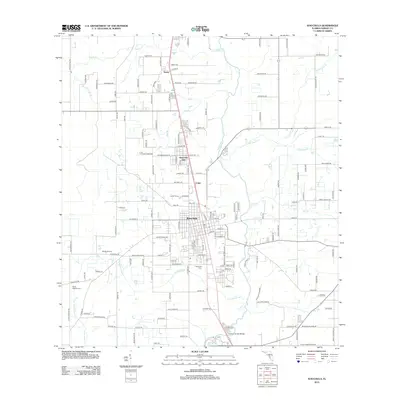
2012 Map of Wauchula
USGS Topo · Published 2012About this map
Wauchula serves as the central hub of this Hardee County landscape, where the town’s grid is anchored by the Post Office and the expansive Wauchula Cemetery to the south. The area’s agricultural identity is clearly defined by local operations such as Wauchula Dairy, Seven Baskets Farm, and Lovett Farms, illustrating the region’s long-standing reliance on citrus and ranching. The Peace River carves through the eastern portion of the map, fed by numerous tributaries including Payne Creek, Hog Branch, and Thompson Branch. Transport corridors like the Old Dixie Highway and various named rural roads connect the smaller settlements of Torrey, Wauchula Hills, and Coker. This detailed look at the early 21st-century landscape shows how suburban developments like Pine Cone Park began to integrate with established groves and creek-fed bottomlands.
Find a feature on this map
152 named features on this map. Tap any name to fly to it.
Don’t see what you’re looking for? This feature index may not catch every label — zoom into the map to look around manually.
Map Details
Editions of this 2012 Wauchula Map
This is the sole edition of this map. No revisions or reprints were ever made.
Other maps of this area

1955 · Ft. Green
USGS Topo · 1:24,000

1955 · Bowling Green
USGS Topo · 1:24,000

1955 · Wauchula
USGS Topo · 1:24,000

1955 · Baird
USGS Topo · 1:24,000

1956 · Ona
USGS Topo · 1:24,000

1956 · Bereah
USGS Topo · 1:24,000

1956 · Sweetwater
USGS Topo · 1:24,000

1956 · Zolfo Springs
USGS Topo · 1:24,000

1956 · Griffins Corner
USGS Topo · 1:24,000

1956 · Fort Pierce
USGS Topo · 1:250,000