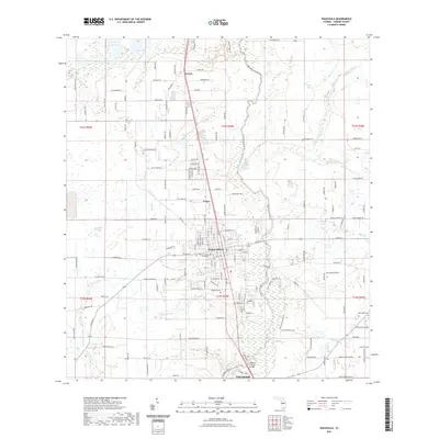
2021 Map of Wauchula
USGS Topo · Published 2021About this map
The Hardee County Courthouse stands as the civic heart of Wauchula, the central settlement in this Florida interior landscape. This modern survey illustrates the town's grid stretching toward the Peace River, which flows south toward Zolfo Springs. The waterway is a dominant natural corridor, paralleled by the Peace River State Trl and crossed by the Doyle E Carlton Bridge. Outside the urban center, the land is marked by agricultural and natural features such as Reaphook Swamp and smaller hamlets like Torrey and Coker. Genealogists and local historians can locate established burial grounds including Wauchula Cem and the more remote New Hope Cem in the eastern reaches. The map's detail provides a clear view of the rural-to-town transition, showing how drainage systems like Thompson Branch and Hog Br feed into the regional river system.
Find a feature on this map
159 named features on this map. Tap any name to fly to it.
Don’t see what you’re looking for? This feature index may not catch every label — zoom into the map to look around manually.
Map Details
Editions of this 2021 Wauchula Map
This is the sole edition of this map. No revisions or reprints were ever made.
Other maps of this area

1955 · Ft. Green
USGS Topo · 1:24,000

1955 · Bowling Green
USGS Topo · 1:24,000

1955 · Wauchula
USGS Topo · 1:24,000

1955 · Baird
USGS Topo · 1:24,000

1956 · Ona
USGS Topo · 1:24,000

1956 · Bereah
USGS Topo · 1:24,000

1956 · Sweetwater
USGS Topo · 1:24,000

1956 · Zolfo Springs
USGS Topo · 1:24,000

1956 · Griffins Corner
USGS Topo · 1:24,000

1956 · Fort Pierce
USGS Topo · 1:250,000