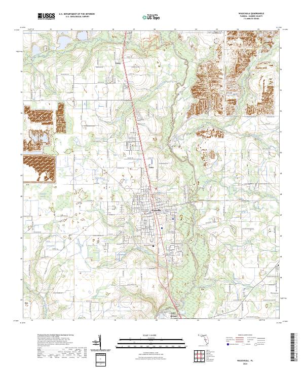
2024 Map of Wauchula
USGS Topo · Published 2024About this map
Wauchula serves as the central hub of this Hardee County landscape, where the Hardee County Courthouse stands as a local landmark. The settlement pattern follows a distinct grid in the town center, bounded by the winding course of the Peace River to the east. The surrounding area is defined by its water system, with numerous tributaries such as Thompson Branch and Hog Branch draining into the river. To the north, smaller communities like Torrey and Coker are situated along the primary north-south corridors, while Zolfo Springs anchors the southern portion of the map.
Find a feature on this map
133 named features on this map. Tap any name to fly to it.
Don’t see what you’re looking for? This feature index may not catch every label — zoom into the map to look around manually.
Map Details
Editions of this 2024 Wauchula Map
This is the sole edition of this map. No revisions or reprints were ever made.
Other maps of this area

1955 · Ft. Green
USGS Topo · 1:24,000

1955 · Bowling Green
USGS Topo · 1:24,000

1955 · Wauchula
USGS Topo · 1:24,000

1955 · Baird
USGS Topo · 1:24,000

1956 · Ona
USGS Topo · 1:24,000

1956 · Bereah
USGS Topo · 1:24,000

1956 · Sweetwater
USGS Topo · 1:24,000

1956 · Zolfo Springs
USGS Topo · 1:24,000

1956 · Griffins Corner
USGS Topo · 1:24,000

1956 · Fort Pierce
USGS Topo · 1:250,000