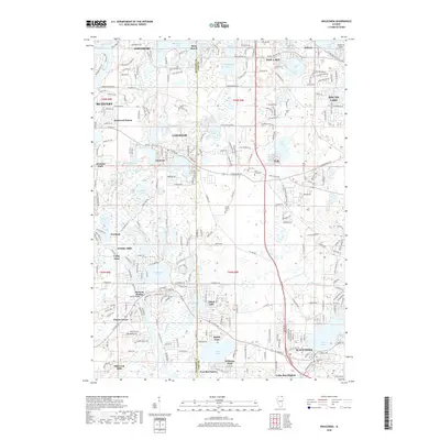
2018 Map of Wauconda
USGS Topo · Published 2018About this map
The glacial terrain of the McHenry Co Lake Co border defines this area, where a dense network of lakes and marshes has shaped local development. Significant water bodies like Bangs Lake, Wooster Lake, and Slocum Lake anchor the surrounding communities of Wauconda and Island Lake. The landscape is notably punctuated by the Volo Bog, a distinctive wetland feature situated near the settlement of Volo. This 2018 survey captures the intricate boundary where these natural basins meet the expanding residential footprints of Fox Lake and Lakemoor.
Find a feature on this map
110 named features on this map. Tap any name to fly to it.
Don’t see what you’re looking for? This feature index may not catch every label — zoom into the map to look around manually.
Map Details
Editions of this 2018 Wauconda Map
This is the sole edition of this map. No revisions or reprints were ever made.
Other maps of this area

1920 · Grays Lake
USGS Topo · 1:62,500

1923 · Grays Lake
USGS Topo · 1:62,500

1923 · Barrington
USGS Topo · 1:62,500

1925 · Elgin
USGS Topo · 1:62,500

1926 · Mc Henry
USGS Topo · 1:62,500

1935 · Barrington
USGS Topo · 1:62,500

1940 · Elgin
USGS Topo · 1:62,500

1944 · McHenry
USGS Topo · 1:62,500

1954 · Rockford
USGS Topo · 1:250,000

1955 · Rockford
USGS Topo · 1:250,000