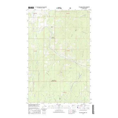
2017 Map of Wauconda Summit
USGS Topo · Published 2017About this map
Old Wauconda sits along the drainage of W Fork Granite Cr in this high-altitude section of the Okanogan National Forest. The landscape is dominated by significant elevations such as Fir Mountain, Clackmas Mtn, and the Wauconda Summit, which serves as a key geographical marker for travelers moving through the Okanogan highlands. This 2017 survey shows a network of forest development roads, including Nat For Dev Rd 31, winding through the timbered slopes and creek bottoms. The Pacific NW National Scenic Trail traverses the eastern and northern portions of the quadrangle, highlighting the area's role in modern recreational geography. Water features like Sweat Creek and Cape Labelle Cr define the local topography, while Corner Butte stands at the southern boundary, providing a clear view of the mountain-and-valley settlement patterns characteristic of north-central Washington.
Find a feature on this map
28 named features on this map. Tap any name to fly to it.
Don’t see what you’re looking for? This feature index may not catch every label — zoom into the map to look around manually.
Map Details
Editions of this 2017 Wauconda Summit Map
This is the sole edition of this map. No revisions or reprints were ever made.
Other maps of this area

1902 · Osoyoos
USGS Topo · 1:125,000

1904 · Osoyoos
USGS Topo · 1:125,000

1904 · Republic
USGS Topo · 1:125,000

1951 · Wauconda
USGS Topo · 1:62,500

1951 · Bodie Mountain
USGS Topo · 1:62,500

1954 · Okanogan
USGS Topo · 1:250,000

1957 · Mt. Bonaparte
USGS Topo · 1:62,500

1957 · Aeneas Valley
USGS Topo · 1:62,500

1958 · Okanogan
USGS Topo · 1:250,000

1958 · Aeneas
USGS Topo · 1:62,500