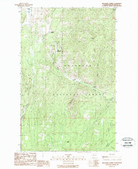
1988 Map of Wauconda Summit
USGS Topo · Published 1988About this map
Old Wauconda and the nearby Wauconda Summit anchor this survey of the high country in northern Washington during the late 1980s. The landscape is defined by the heavy timber and drainage patterns of the Okanogan National Forest, where high points like Clackamas Mtn and Fir Mountain overlook a network of critical headwaters. Several major drainages converge here, including West Fork Granite Creek, Sweat Creek, and Labelle Creek, reflecting the importance of water management in this mountainous terrain. The map records several Gravel Pits and a Campground, indicating the area's continued use for resource extraction and recreation within the national forest system. While primary roads are established, large sections are marked as Restricted, particularly along the southern slopes of Fir Mountain and near Gardner Creek, likely indicating managed forest access or protected zones during this period of land management.
Find a feature on this map
24 named features on this map. Tap any name to fly to it.
Don’t see what you’re looking for? This feature index may not catch every label — zoom into the map to look around manually.
Map Details
Editions of this 1988 Wauconda Summit Map
This is the sole edition of this map. No revisions or reprints were ever made.
Other maps of this area

1902 · Osoyoos
USGS Topo · 1:125,000

1904 · Osoyoos
USGS Topo · 1:125,000

1904 · Republic
USGS Topo · 1:125,000

1951 · Wauconda
USGS Topo · 1:62,500

1951 · Bodie Mountain
USGS Topo · 1:62,500

1954 · Okanogan
USGS Topo · 1:250,000

1957 · Mt. Bonaparte
USGS Topo · 1:62,500

1957 · Aeneas Valley
USGS Topo · 1:62,500

1958 · Okanogan
USGS Topo · 1:250,000

1958 · Aeneas
USGS Topo · 1:62,500