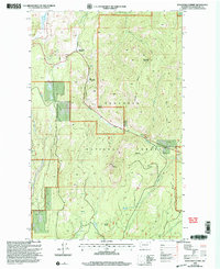
2001 Map of Wauconda Summit
USGS Topo · Published 2004About this map
Old Wauconda sits along the West Fork drainage in this high-elevation landscape within the Okanogan National Forest. The map reflects a period of modern land management where 20th-century revision by the USDA Forest Service has updated the layout of forest roads and trails that traverse the steep drainages. Notable peaks like Clackamas Mountain, Fir Mountain, and Corner Butte define the topography, with numerous springs feeding into a network of creeks including Labelle Creek, Frosty Creek, and Gardner Creek. The presence of Wauconda Summit and the nearby Old Wauconda label provides a clear view of the shifting footprint of human activity in this corner of Washington, while several Gravel Pits and a Gravel Pit indicate localized industrial activity related to road maintenance or resource extraction in the high country.
Find a feature on this map
26 named features on this map. Tap any name to fly to it.
Don’t see what you’re looking for? This feature index may not catch every label — zoom into the map to look around manually.
Map Details
Editions of this 2001 Wauconda Summit Map
2 editions found
Other maps of this area

1902 · Osoyoos
USGS Topo · 1:125,000

1904 · Osoyoos
USGS Topo · 1:125,000

1904 · Republic
USGS Topo · 1:125,000

1951 · Wauconda
USGS Topo · 1:62,500

1951 · Bodie Mountain
USGS Topo · 1:62,500

1954 · Okanogan
USGS Topo · 1:250,000

1957 · Mt. Bonaparte
USGS Topo · 1:62,500

1957 · Aeneas Valley
USGS Topo · 1:62,500

1958 · Okanogan
USGS Topo · 1:250,000

1958 · Aeneas
USGS Topo · 1:62,500